


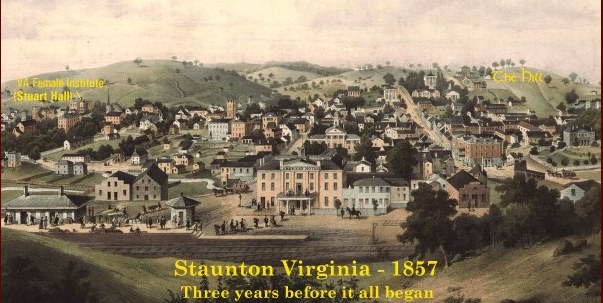
THEN: Thirteen years later, the panoramic or perspective map, also known as a bird's-eye view, was made--a popular cartographic form used to depict communities between the nineteenth and twentieth centuries. Generally not drawn to scale, they show street patterns, individual buildings, and major landscape features in perspective.
The 1891 map above is from the archives of the Library of Congress, and it is mapped so that you may click on the yellow names and the yellow frame to view a close-up. Use your BACK feature to return to the map, or scroll back up from the larger view.If you wish to see areas in greater detail that are not enlarged below, the Library of Congress link in the paragraph above will take you to the original 1891 image, and clicking anywhere on the 1857 image will take you to its original, both of which are in a special, interactive format that allows you to zoom in on any area and present it in one of many screen-size options. Enjoy!

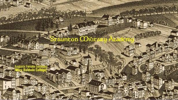
This image shows that, 31 years into its storied history, SMA had at least one large building that didn't make it to the 1930's. This may well be the earliest "picture" of SMA that exists, other than the 1888 catalog art-work image above. Which, if any, of the buildings around it were part of the Academy is unknown to this writer. The large building occupies area nearly between South Barracks and the Administration building, , while the clear, dark area to the right of the large building approximates the location of the asphalt. The main road to Weiland Gate was laid between the two isolated buildings on the slope of the hill to the right of the large building and asphalt area.The image also shows that Augusta Female Seminary, to become Mary Baldwin College, had many major buildings on the site.
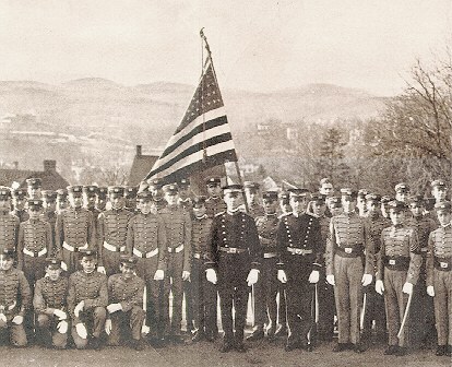
Eleven years later, the 1902 Corp of Cadets poses with the hills of Staunton in the background.
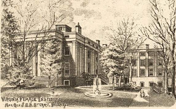
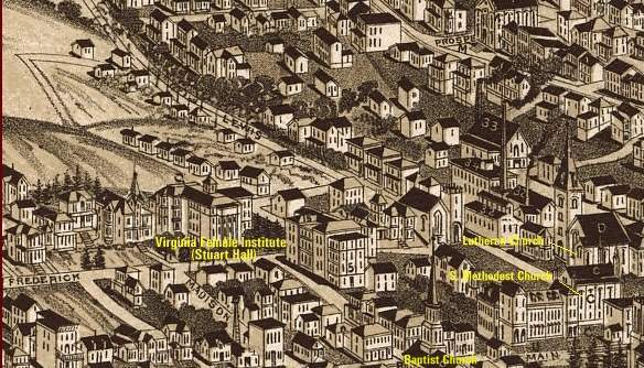
The perspective map provides clues into various social mores of the time. In this enlargement of the map's inset of the picture of Virginia Female Institute (Stuart Hall), the personal title, "Mrs. Gen. Jeb" applied to Mrs. Stewart, also the founder, indicates the subordination of women that was common and accepted practice in that era.

The most interesting thing about the legend is its lack of "political correctness" by today's standards. Certainly not arranged alphabetically, it also does not have a strict ordering based upon locations; so, through it, some indication of the order of importance of things is derived.
Photo Copyright © Malcolm Kantzler, SMA ' 65; scanning capability courtesy Hunter Henry, SMA '46
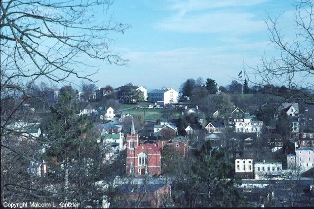
NOW: This is The Hill today, as seen from across town to the west, from the top of the hill that has Stuart Hall at its base, looking east. Flagpole Hill is obvious, and the Super's house to the left, and below that the parking lot near where South Barracks stood. Further to the left is the new MBC Student Center building, then the old Admin/Mess Hall, and under the branches, the pillars of Kable Hall and part of Memorial Hall are visible.
